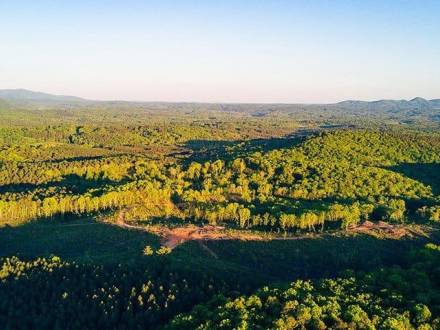
Dawson Forest Wildcat Tract
Eastern Wildcat Tract Trails
Access to this network of connected trails is normally off Steve Tate Road in the northeastern part of the county. To reach Wildcat Creek Trail, take Steve Tate north until you are just past Pleasant Union Baptist Church. At that point, take a left onto Wildcat Campground Road, a well-maintained gravel road that descends into the valley for about a mile. Keep an eye on the right for scenic views of the Amicalola River far below in a rocky gorge. The road dead ends as it flattens out in the river bottom, and an information kiosk with trail information on the left as you enter the campground area will provide details on the three area trails.
Wildcat Creek Trail
Wildcat Creek Trail is about 1.5 miles long and begins just upstream of the campground area. A small footbridge across the Amicalola provides access, and the trail follows Wildcat Creek along its length. Mountain laurels, azaleas, rhododendrons, and other flowering mountain species dot the ridgelines as the trail follows a gentle course through the mostly flat valley. Some uphill sections and trail obstructions, including logs and rocks, and an easy ford across Wildcat Creek, are easily negotiated even by children. However, Wildcat Creek Trail still provides a solitary, backcountry hiking experience within an hour of a major metropolitan area. Hikers can finish the hike and return by the same trail, or join up with Falls Creek Trail.
Falls Creek Trail
Falls Creek Trail is a more challenging hike, with significant elevation gain and more rugged conditions than Wildcat Creek. Turner Trail is part of an old homestead tract known as the Turner Estate, and provides access to the upper Wildcat Creek area over almost two miles of improved trail following an old road bed. To reach Turner Trail, go past the Wildcat Campground Road on Steve Tate Road to the trailhead at Turner Bridge where it crosses the Amicalola. Turner Trail ends up on Wildcat Creek, not far from the upper end of the Wildcat Trail. This trail section also connects to Rocky Ford Trail as well as other unnamed trails in the area. Windy Ridge Trail begins at mile 1 on the Turner Trail and is a fairly strenuous hike to the summit of a 2,500-foot mountain ridge, and connects back to the Eastern Wildcat trail system by either the Rocky Ford Trail or the Wildcat trail.
Western Wildcat Tract Trails
The Western Wildcat Tract offers a mountain backcountry experience to visitors. Beginning at the 3,000-foot level high on a mountain ridge with views of Dawson, Pickens, Cherokee, and surrounding counties, the trails in this section drop sharply to the valley floor west of Wildcat Creek. Access is via Monument Road. Take Highway 136 West off Georgia 400 to the Dawson-Pickens County border and turn left onto Monument Road. The trailhead is about three miles south of Highway 136 on Monument Road, and is marked with an information kiosk. The three trails are all steep descents and ascents, and are not suitable for young children or those unprepared for a heart-pounding hike. Be advised that the laws of nature are reversed in this case; what goes down must come up, and the trail out of the mountain valley will seem much steeper than it did on the way in.
Tobacco Pouch Trail
Tobacco Pouch Trail starts at the trailhead and follows an old logging road, crossing the Falls Creek Trail and heading south on an old roadbed, again meeting the Falls Creek Trail further down.Falls Creek TrailFalls Creek Trail's "other end" begins on the western edge of the Wildcat Tract off the Monument Road trailhead a short distance up the Tobacco Pouch Trail. Falls Creek is aptly named – as you hike along the creek, cascades and falls are a constant companion – the 100-foot Falls Creek Fall is the largest in the Wildcat Tract. Hikers can continue down the roadbed to the creek valley floor and then up to join the Tobacco Pouch trail at the aforementioned second junction and head back to the Monument Road trailhead, or can continue on to the junction with the Eastern Wildcat Tract trail system.
Rocky Ford Trail
Rocky Ford Trail is the third to begin from the Monument Road trailhead system, starting 1.2 miles from the entrance at its junction with the Tobacco Pouch Trail. Rocky Ford is just as steep as its counterparts in the first half mile, then gradually drops down to cross Rocky Ford Creek and joins with the Turner Trail that connects back to the Wildcat Campground trailhead.

